
A range of public transport network maps has been produced to help locals and visitors navigate Victoria's metropolitan and regional public transport systems. You can use these maps to discover what public transport options are available in a particular area and to help you plan your journey.
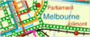
The Metropolitan Public Transport Map shows the complete bus, tram and train network throughout Melbourne.
The local area profiles provide maps and information about public transport services that operate in various city councils. Select a local area from the list below or enter a suburb into the Transport Search at the right of this page.
 |
 |
 |
 |
|
City Circle tram service |
City Saver area |
||
 |
 |
 |
|
|
NightRider after midnight buses |
V/Line services |
Every train station, bus and tram stop in Melbourne and Victoria has an address and special features such as lockers, public toilets, wheelchair access, car parking and ticket vending machines.
You can perform a search to find out what facilities are available at every train station, tram and bus stop throughout Melbourne and Victoria in the Station & stop information section of this website. Alternatively, click on the links below to take you directly to the search for each mode of transport.
Metropolitan train stations search
Metropolitan tram stops search
Metropolitan bus stops search
Regional stops and stations search
