
Maps stations stops
Public transport maps
A range of public transport network maps has been produced to help locals and visitors navigate Victoria's metropolitan and regional public transport systems. You can use these maps to discover what public transport options are available in a particular area and to help you plan your journey.
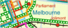
The Metropolitan Public Transport Map shows the complete train, tram and bus network throughout Melbourne.
Local travel guides
The local travel guides provide maps and information about public transport services that operate in local government areas. Select a local area from the drop-down list below or enter a suburb into the Route / line search at the right of this page.
Printed guides that are small enough to fit into your pocket and bag are available. Call Metlink on 131 638 to request your free copy.
Some local travel guides are being updated. You can see a list of services in your local area by searching in the menu below but some maps are not available.
Public transport network maps are also available for
 |
 |
 |
 |
|
City Circle tram service |
City Saver area |
||
 |
 |
 |
|
|
NightRider after midnight buses |
V/Line services |
